ALMA Sistemi Srl (ALMA) is an Italian SME that provides high-level consultancy in space and defense market for industries and research centers. It provides project and proposal/offer management services, commercial development, market analysis, systems and software engineering within the programs of the European Space Agency, the European Union and the Italian Space Agency. ALMA is concerned with helping customers, research organizations and industries to exploit new technologies and new management styles, by identifying potential opportunities, making project proposals and new product and service development plans, analyzing and preparing marketing strategies, implementation of management and quality standards and sustainable development strategies. Experience has been acquired by implementing a wide range of projects in the following sectors: aerospace, engineering, research and IT. Alma also participates in the development of high-level software for aerospace applications with particular regard to remote sensing, image processing and control systems. Over 12 years of commercial development and preparation of proposals, including market analysis and business plan for the main aerospace industries in Europe, in a series of ESA programs for earth observation (GMES, MeteoSat), telecommunications (ARTES), navigation (Galileo), planetary exploration (ExoMars), Science and Human Spaceflight.
ALMA will contribute to the development of RESEARCH thematic platform and to data integration and fusion of different remote sensing techniques in the RESEARCH platform. Complementary skills include Project and Proposal management, Leadership, Entrepreneurship, dissemination and exploitation of the developed technologies, and project results. Specific topics of the project are (i)Remote Sensing for soil erosion and land-use change, (ii)Software development, (iii) Data integration and data processing, (iv)Archaeological GIS and WebGIS applications, (v)Commercial Exploitation.
Personnel involved
He has a Degree in astronomy and a Master in Information Technology, founder and CEO of ALMA. Within the Project he is Partner’s responsible and experienced researcher. His research topics include Geomatics, GIS, and Cultural Heritage Technologies. He was/is involved in the following National, EU and International Projects:
CLIMA (Cultural Landscape risk Identification Management and Assessment), JPI Cultural Heritage Plus (2015 – 2018)
STABLE (Structural Stability Risk Assessment) By H2020-MSCA- RISE – 2018 n.823966 (2018-2022)
RESEARCH (REmote SEnsing techniques for ARCHaeology – funded by H2020-MSCA-RISE-2018, num. 823987)
External link/s: https://www.linkedin.com/in/diiorio
He is a Software Developer, currently Software Developer, Websites Manager, Server Infrastructure Manager at ALMA. Within the Project he is technical staff, working at the development and implementation of the RESEARCH Platform. His expertise is software and hardware design, implementation, and management. He was/is involved in the following National, EU and International Projects:
CLIMA (Cultural Landscape risk Identification Management and Assessment), JPI Cultural Heritage Plus (2015 – 2018)
STABLE (Structural Stability Risk Assessment) By H2020-MSCA- RISE – 2018 n.823966 (2018-2022)
RESEARCH (REmote SEnsing techniques for ARCHaeology – funded by H2020-MSCA-RISE-2018, num. 823987)
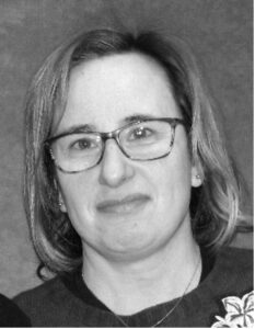
She is an Urban Planner, currently working as GIS Analyst for ALMA. Within the Project she is technical staff, working at the RESEARCH platform. Her research topics include urban and landscape studies, software for data analysis, and cartography. She was/is involved in the following EU Projects:
CLIMA (Cultural Landscape risk Identification Management and Assessment), JPI Cultural Heritage Plus (2015 – 2018)
STABLE (Structural Stability Risk Assessment) By H2020-MSCA- RISE – 2018 n.823966 (2018-2022)
RESEARCH (REmote SEnsing techniques for ARCHaeology – funded by H2020-MSCA-RISE-2018, num. 823987)
External link/s: www.linkedin.com/in/roberta-orsini-1d88.
She has a Degree in Economy, currently working as Accounting Manager at ALMA. Within the Project she is project controller for ALMA, expert in business planning. She is involved in the following EU Projects:
STABLE (Structural Stability Risk Assessment) By H2020-MSCA- RISE – 2018 n.823966 (2018-2022)
RESEARCH (REmote SEnsing techniques for ARCHaeology – funded by H2020-MSCA-RISE-2018, num. 823987)
He is a Civil Engineer – Teacher of Geomatics, Senior Consultant at ALMA. Within the Project he is technical staff. His research topics include Geomatics, GIS, Cultural Heritage Technologies. He was/is involved in the following National, EU and International Projects:
BISNET (A telematics service providing technical information about materials and works in the building sector. EU IMPACT 2 Grant agreement ID: 4027).
REFRAN (EU 598 in Eureka Eurocare framework Project Leader of first European project with Italian leadership in the field of cultural heritage documentation, cataloguing and monitoring).
ARCHAEOLOGIS (Archaeological Multimedia Data Management and Diffusion IS-INFO2000 INFMM3013).
ARCHEOGUIDE (Augmented Reality-based Cultural Heritage On-site Guide EU Grant agreement ID: IST-1999-11306 FP5).
LIFEPLUS (Innovative revival of LIFE in ancient frescoS and creation of immerse narrative sPaces, featuring reaL scenes with behavioUr fauna and flora. EU Grant Agreement ID: IST-2001-34545 LIFEPLUS).
RESEARCH (REmote SEnsing techniques for ARCHaeology – funded by H2020-MSCA-RISE-2018, num. 823987)
STABLE (Structural stABiLity risk assEssment – funded by H2020-MSCA-RISE-2018, num. 823966)
eUMaP (Development of Utilities Management Platform for the case of Quarantine and Lockdown- funded by H2020-MSCA-RISE-2020 num. 101007641)
External link/s: https://www.linkedin.com/in/renzocarlucci; https://twitter.com/rcarlucci; https://www.instagram.com/renzocarlucci/; https://www.facebook.com/renzo.carlucci/.
He is a MSc Geoinformatics, currently GIS and Earth Observation Specialist at ALMA. Within the Project he is technical staff, working at GIS programming, Python in QGIS, and automatization process development. His research topics include GIS Automatization, developing open-source plugins in QGIS and Geo-databases, and handling Spatial Data. He is involved in the following EU Projects:
RESEARCH (REmote SEnsing techniques for ARCHaeology – funded by H2020-MSCA-RISE-2018, num. 823987)
STABLE (Structural stABiLity risk assEssment – funded by H2020-MSCA-RISE-2018, num. 823966)
External link/s: https://www.linkedin.com/in/philipfayad/.


