The Cyprus University of Technology (CUT) is a public university founded in Limassol in 2003 and consists of six faculties. Times Higher Education World University Rankings for 2018/19 ranked the Cyprus University of Technology in the top 301-350 universities of the world; the University also received the highest score among all universities in Cyprus and Greece. Cyprus University of Technology (CUT) enrolled its first students in 2007. With its orientation towards applied research, the University aspires to establish for itself a role in support of the state and society in their efforts to confront problems, which cover all areas of science and technology. CUT is an advanced University equipped with the most modern infrastructures and technological equipment which makes it possible to be the strongest on the island in research, with specialized units directed by distinguished professionals. The vision of the Department of Civil Engineering and Geomatics (CEG) is to develop a dynamic, stimulating and challenging environment for teaching and research of the highest international standard. In addition, the Department aims to establish strong interactions with industry and government to provide students the opportunity to participate in current engineering and technology developments and work alongside professionals through individual and team project work and professional training. The Remote Sensing and Geo-Environment Lab/ ERATOSTHENES Group has been established within the Department of Civil Engineering and Geomatics of CUT since 2007 and has a 13-year experience in earth observations and geospatial analysis. Since 2007, the The Remote Sensing and Geo-Environment Lab has participated in more than 75 funded projects with funding sources from HORIZON 2020, JPI, FP7, FP6, ECHO, Eureka, Life +, MED, Marie Curie, ERASMUS+, COST, ESA, EC regional funds, national funds such as the Cyprus Research Promotion Foundation (CRPF) and industry. The ‘Remote Sensing and Geo-Environment Lab’/ ERATOSTHENES Group has received the biggest funding within CUT and through “EXCELSIOR” H2020 (Excellence Research Centre for Earth Surveillance and Space-Based Monitoring of the Environment; TEAMING Grant no. 857510) (www.excelsior2020.eu), has been upgraded to ERATOSTHENES Centre of Excellence (CoE) (www.eratosthenes.org.cy). ERATOSTHENES CoE activities are strengthened by an extended network of international partners.
Personnel involved
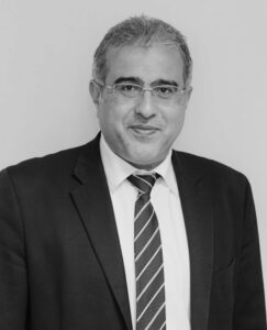
He is a PhD in Remote Sensing: University of Surrey, Department of Civil Engineering, UK (1996-1999), currently Professor at CUT. Within the Project he is Partner’s responsible and experienced researcher. His research topics include Earth Observation, Geoinformation, Remote Sensing Applications for Natural and Built Environment. He was/is involved in the following National, EU and International Projects:
‘EXCELSIOR’ H2020 Teaming Project, https://excelsior2020.eu
‘ATHENA’ H2020 Twinning Project https://athena2020.eu/,
‘SWSOIP’ ESA PECS Smart Watering System for Optimising Irrigation Process https://www.swsoip.com/
‘DECAT’ European Union Civil ProtectionFunded Project https://decatastrophize.eu/,
‘NAVIGATOR’ Excellence Hub funded Project from the Research and Innovation Foundation (RIF) http://web.cut.ac.cy/navigator/,
‘SIROCCO’ Excellence Funded Hub Funded from the Research and Innovation Foundation (RIF) https://sirocco.cut.ac.cy/
‘MARINE SPATIAL PLANNING-2’ (THAL-XOR-2) Interreg Funded Project, https://www.mspcygr.info/
‘GEO_CRADLE’ Coordinating and Integrating State-of-the-Art Earth Observation Activities in the Regions of North Africa, Middle East, and Balkans and Developing Links With GEO Related Initiatives Towards GEOSS, H2020 Funded Project, http://geocradle.eu/
‘CopHub.AC’ – Copernicus Academy Hub for Knowledge, Innovation and Outreach, H2020 Funded Project, http://www.cophub-ac.eu/
External link/s: https://www.cut.ac.cy/faculties/fet/ceg/staff/d.hadjimitsis/?languageId=1#a; www.eratosthenes.org.cy
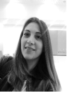
She is a MSc Geography and Applied Geo-Informatics in Environmental and Risk management: University of the Aegean, Department of Geography (2016-2018); BSc in Marine Sciences: University of the Aegean, Department of marine Sciences (2012-2016), currently Research Associate at CUT. Within the Project she is early-stage researcher. Her research topics include Land movement estimation, geotechnical stability, soil displacement, safeguard of archaeological sites, risk assessment. RESEARCH is her first experience in National, EU or International Projects.
External link/s: https://www.researchgate.net/profile/Despoina_Makri; https://www.linkedin.com/in/despina-makri-b76454125/.
She is a MSc Geoinformatics and Geospatial Technology, currently PhD student in soil erosion estimation on archaeological sites at CUT. Within the Project she is early-stage researcher. Her research topics include soil erosion estimation, erosion risk models, safeguard of archaeological sites, risk assessment procedures for CH. RESEARCH is her first experience in National, EU or International Projects.
External link/s: https://www.researchgate.net/profile/Nikoletta_Papageorgiou3
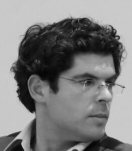
He is a PhD in Remote Sensing in Archaeology, currently Researcher at CUT. Within the Project he is a member of the CUT management team and experienced researcher. His research topics include Remote Sensing, Spectroscopy, Geographic Information Systems (G.I.S.) and Geometric Documentation intended for archaeological research and Cultural Heritage. He was/is involved in several National, EU and International Projects, among which:
CLIMA (Cultural Landscape risk Identification Management and Assessment), JPI Cultural Heritage Plus (2015 – 2018)
RESEARCH (REmote SEnsing techniques for ARCHaeology – funded by H2020-MSCA-RISE-2018, num. 823987)
NAVIGATOR’ Excellence Hub funded Project from the Research and Innovation Foundation (RIF) http://web.cut.ac.cy/navigator/
External link/s: https://www.researchgate.net/profile/Athos_Agapiou; https://www.cut.ac.cy/faculties/fet/ceg/staff/athos.agapiou/#a.
She is a PhD in Water Spectroscopy and Remote Sensing, currently Researcher at CUT. Within the Project she is a member of the CUT management team and experienced researcher. Her research topics include water resources management, surface water quality monitoring of inland & coastal water bodies, risk assessment for aquatic ecosystems/ spotting of pollution sources using space technologies, Remote Sensing and GIS for environmental applications, ground field spectroscopy, natural hazard risk management, climate change, floods. She was/is involved in the following National, EU and International Projects:
‘EXCELSIOR’ H2020 Teaming Project, https://excelsior2020.eu
‘ATHENA’ H2020 Twinning Project https://athena2020.eu/,
‘SWSOIP’ ESA PECS Smart Watering System for Optimising Irrigation Process https://www.swsoip.com/
‘MARINE SPATIAL PLANNING-2’ (THAL-XOR-2) Interreg Funded Project, https://www.mspcygr.info/
‘CopHub.AC’ – Copernicus Academy Hub for Knowledge, Innovation and Outreach, H2020 Funded Project, http://www.cophub-ac.eu/
‘SEO-DWARF’ (H2020 MSCA RISE 2015) – Semantic EO Data Web Alert and Retrieval Framework
‘CyCLOPS’ (RPF/RIF) – Cyprus Continuously Operating Natural Hazards Monitoring & Prevention System
External link/s: https://www.researchgate.net/profile/Christiana_Papoutsa; https://www.cut.ac.cy/faculties/fet/ceg/staff/christiana.papoutsa/
