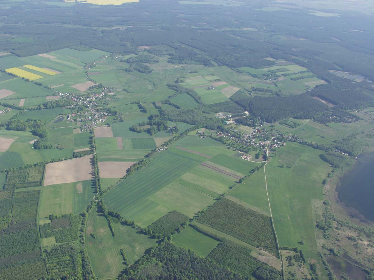
| Research area | Sławno-Darłowo area (Pomerania) | |
| GPS Coordinates | 54°25’58.60” N 16°33’05.20” E Coordinate System: WGS 84 Zone: 33N |
|
| Extension | NW corner: 54°28’25,15” N 16°18’50,66” E |
NE corner: 54°28’32,28” N 16°54’51,74” E |
| SW corner: 54°21’58,56” N 16°18’54,38” E |
SE corner: 54°21’58,16” N 16°46’02,11” E |
|
| Site description | Landscape was shaped by last glacier which left flat and hilly moraines as well as variety of valleys (wide and narrow). Currently the area is under anthropopressure (mostly farming but also forestry). Seashore is also under pressure due to the tourism development. There is also spatial expansion of two main towns: Darłowo and Sławno. During field-walking projects in 1980s and 1990s almost 700 archaeological sites were discovered. The survey confirms human occupation of the area since the Mesolithic till Middle Ages. Many sites still need to be discovered (mostly in forested areas). | |
| Threats | Farming is the dominating activity in the area. Erosion seems to be the main threat for most of discovered sites because of the mix of sandy and clayish soils as well as hilly topography (especially steep slopes). Fields are rather small and each farmer provides his own strategy of cultivating (crops, ploughing, fertilizing). It has an impact on the soil formation processes and it also limits the application of aerial photographs as a prospection method for the whole region.
The other part of the region is covered by forests and erosion does not appear then. Many earthworks are still standing and visible in the landscape. For those kind of sites, trees’ root systems seem to be the main threat. The third threat relates to the urban sprawl – there are two main towns in the area (Sławno and Darłowo) and their spatial expansion got very negative impact on the existing and known sites. Also resorts develop quickly along the sea shore. |
|
| Hazard assessment | Soil erosion Land use/cover change |
|

